



Last Updated:
Google Maps is now tracking traffic on Delhi’s Barapullah Phase 3. Yet, bottlenecks remain – and road design is under scrutiny




Delhi Traffic News: The availability of live traffic data gives commuters a way to assess delays before committing to the Barapullah route.
Delhi Traffic News: Motorists using Delhi’s Barapullah elevated corridor can now check live traffic conditions on Google Maps, nearly four weeks after Phase 3 opened to vehicles. The change follows a request from the Delhi Traffic Police, which had flagged difficulties faced by commuters trying to gauge congestion on the new stretch and decide whether to take another route.
Two senior traffic police officers confirmed the development on Friday. According to one officer, the company took a few days to act on the request, with live updates becoming available last Monday. Drivers can now check conditions before entering the corridor and consider alternatives such as the Delhi Noida Direct (DND) route, NH-24 or Vikas Marg if traffic is building up, as reported by Hindustan Times.
The mapping update could make route planning easier, but it has not eliminated the traffic problems around the corridor. Officials and transport experts have pointed to shortcomings in the road layout as a more fundamental concern.
Why Barapullah Phase 3 Is Facing Congestion
The lack of traffic information for the new stretch had made it harder for drivers to anticipate delays, and Delhi Traffic Police had identified this as one of several factors behind congestion on the corridor and nearby roads.
However, experts have focused on how traffic enters and moves through the elevated road. They have raised concerns about the way merging lanes are configured and whether the layout can handle vehicles arriving from different approaches without creating bottlenecks.
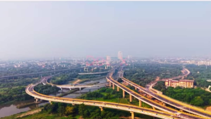
The issue was highlighted by an aerial survey carried out by the traffic police. It found several locations where two separate three-lane roads converged into a single three-lane corridor. Such arrangements can force streams of traffic to compete for the same available road space, increasing the likelihood of slowdowns.
Traffic Police Seeks Details From PWD
Delhi Traffic Police has approached the Public Works Department (PWD) twice for information about significant design changes made to the newly opened section.
The requests come amid questions over the corridor’s merging points and their impact on traffic movement. Experts have argued that the geometry of these junctions does not follow established traffic-engineering principles, making serious congestion a foreseeable outcome rather than simply a navigation problem.
The concerns were also raised in a report earlier this month, which examined how the merging arrangements could contribute to traffic piling up on the route. Google Maps’ latest update may help drivers avoid some delays, but it does not change the physical configuration of the road.
Where Traffic Jams Continue Around Barapullah
Although traffic has become smoother in both directions on the new section, congestion remains on the stretch between Sarai Kale Khan and INA Market. The problem is especially noticeable during the morning and evening rush hours.
The ramps connecting Barapullah to Ring Road are also continuing to cause trouble. These include the connections near Sundial Park and the Siddharth Extension gurdwara, where vehicles entering and leaving the elevated corridor must negotiate the adjoining road network.
The effects extend beyond the flyover itself. Ring Road continues to experience traffic build-ups between Ashram flyover and Sarai Kale Khan flyover, particularly on the stretch carrying vehicles towards IP flyover from Ashram Chowk and Lajpat Nagar.
Will Google Maps Help Ease The Commute?
The availability of live traffic data gives commuters another way to assess delays before committing to the Barapullah route. Drivers may be able to divert towards the DND, NH-24 or Vikas Marg when conditions warrant, instead of discovering a queue after entering the corridor.
However, the persistence of jams at merging points and connecting roads points to a wider infrastructure challenge. While better traffic information can help motorists make more informed choices, resolving the recurring bottlenecks may require attention to the corridor’s design and its connections with Ring Road.
For now, commuters can use the updated map information to plan their journeys, but should continue to expect delays around Sarai Kale Khan, INA Market and the Barapullah ramps during peak periods.
Quick Answers
 Ask News18
While Google Maps live tracking helps drivers check conditions beforehand, fundamental infrastructure issues and poor road layouts continue to cause severe congestion. Experts and transport officials point to problematic merging points where multiple streams of traffic compete for limited road space.
Ask News18About the Author

A sociologist by training and a storyteller by profession, I spend my days shaping news, and when I’m not chasing deadlines, I’m exploring new places, discovering different cultures and tasting unique…Read More
Delhi, India, India
October 24, 2026, 10:46 IST
Read More